Four Corners Tour – Pre-Planning Stuff #1

For the past couple weeks leading up to my epic Unofficial, Unducumented Four Corners Ride, I have been doing all the typical planning that I’m sure everyone does, plus some planning many might not want to take the time to do, or be inconvenienced by. One of the primary things that had to be done, was to plan my route, which includes all the places to stop and spend the night. Since I will be camping the vast majority of the nights, I first had to determine my preferred daily distance, which has evolved to 400 miles per day.
I can’t give you a definitive reason for that particular mileage, but on the trips I have done between 500 and 700 miles per day, I find myself really tired, and not as sharp as I think I need to be (I don’t like to ride when I am exhausted, there is enough risk with just climbing onto a motorcycle to not be adding unnecessarily dangerous conditions to the mix). So somewhere along the way I determined that 400 miles per day was a comfortable distance for me, which precluded the need to get up at the butt crack of dawn to make it to my destination, or to ride as the sun goes down (I prefer my ride times to not put me looking directly into a rising or setting sun). My vision is not what it used to be, and I feel it compromises my safety to ride after the sun has set unless it is just absolutely necessary. I’m not saying I never ride at night, but I don’t like riding in unfamiliar territory at night after a long day of riding.
So now I will probably bang on a few folks nerves with the next part of my planning. If you are anything like me, in spite of living in the most amazing time in history as it relates to technology, trip planning with what is available to us can be just plain painful. As good as Google Maps are, they have a few critical flaws that make Google Maps a non starter for planning a long trip, the least of which is the inability to get the map from your computer to your GPS. Add to that its 10 way-point limitation, its inability to save a route and you simply can’t plan a long trip, produce a single map with your entire route illustrated and export that map to your GPS.
I won’t waste my breath attempting to tell you how many ways I hate Garmin’s Base Camp software. So for me personally, until someone enlightens me to a better process, I plan the initial way-points using Google Maps, but then, once I get the route like I want it, I start the process of transferring that to Tyre to Travel. The primary reason I can’t just use Tyre is that it does not have the ability to drag and drop your route that works (it tries to add way-points for every change), you simply have to let it plan the route with the few criteria you can enter, and that route is what it is. It also will not display campgrounds and/or hotels along the route, which Google Maps does.
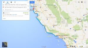
So, I plan a few way-points (up to 10, but usually just two at a time) with Google Maps, then drag the route to the roads I want to ride, then go to Tyre and replicate the process by adding a bunch of way-points to force Tyre to use the roads I want to ride. Even Google Maps is a pain when you want to ride the entire length of Skyline Drive, which connects to Blue Ridge Parkway. No matter how you hold your mouth, Google wants you on Interstate 81, and it forces you to add about 200 way-points to keep the route on the Parkway. I’m all ears if someone knows a better way.
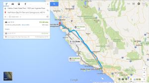
So the process goes a lot like this, I enter my start point into Google Maps (typically my home address), then enter my best guess at a destination address for the first day that will not exceed 400 miles. If I guess wrong, I play around with the destination until I find an appropriate destination within my distance preference (usually, once I find a city that works, I enter my search address as “campgrounds close to ‘cities name'”). Once the destination is determined and that route is calculated, I then either choose from the proposed routes (there is usually more than 1), or start sliding it around to get the best route for the riding experience.
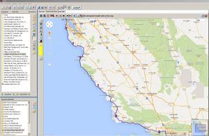
Then I go to Tyre, and try to reproduce that route by adding how ever many way-points I have to add to achieve that route. It takes a lot more time than it should, but the end result is worth it to me. I have a map of the entire ride, and I can export it to my GPS.
I’ll most likely post a few more of these pre-planning posts since I find it necessary to plan everything I can before hand to minimize my frustration on the road. Test, test and test again, a process that allows me to pre-determine what I need to take with me, and prevents me from running into big troubles during my tour.
Having too few bungee cords can be a big mistake, or forgetting to bring a few rolls of toilet paper along just in case, or the all too familiar, leaving the phone charger behind. I’ll post my checklist at some point, and hopefully it will not reveal some sort of character flaw and/or mental illness.


You may already know this feature on Googlemaps, but judging from the interstate 81 comment… you may not. When I use Googlemaps to see where I want to go I almost always click the drop down settings button an click the avoid major highways/interstates option and then click and drag my way points from there. It’s also one of the few features that’s also available on the mobile version though it’s a lot more difficult to find there…. definitely would love some improvements on both the desktop and mobile versions of Googlemaps.
Chris, thanks for the comment. Yep, I’m aware of the Avoidance options, but the problem with a long trip is you can’t turn it on for part and off for part. It is either on, or off. On a multi-day trip (or in this case a multi-week trip), there are parts of the trip that need to utilize the interstate, and other parts that don’t, and I usually want/need both in the same day.
The dragging of the route is the most useful feature in my opinion, which allows a bunch of quasi waypoints (a lot more than the 10 waypoints that can be added in the dialog box), but even it has it’s limitations (you just can’t drag the entire route off of all the surrounding roads onto Skyline Drive/Blueridge Parkway).
Even with it set to avoid highways, it still wants you to take any route other than the Skyline Drive/Blueridge Parkway route, and you run out of quasi waypoints with the drag option before you get the whole route completed. I suppose for the time being, I will just have to maintain this love/hate relationship with Google maps.